Available PhD Projects
ExaGEO equips students with the skills, knowledge, and principles of exascale computing — drawing from geoscience, computer science, statistics, and computational engineering — to tackle some of the most pressing challenges in Earth and environmental sciences and computational research. Students will work under expert supervision in the below fields:
- Atmosphere, hydrosphere, cryosphere, and ecosystem processes and evolution
- Geodynamics, geoscience and environmental change
- Geologic hazard analysis, prediction and digital twinning
- Sustainability solutions in engineering, environmental, and social sciences
Each student will be positioned within a supervisory team consisting of multidisciplinary supervisors; one computational, one domain expert, and one from an Earth or environmental, and/or social science research background. This ‘team-based’ supervisory approach is designed to enhance multidisciplinary training.
Please note that some projects may have incomplete supervisory teams, however the full teams will be finalised before the start of the PhD.
Project Selection and Information
- You must apply for three projects. Each project has two project variations, i.e., teaser projects. During your first year, after working on both teaser projects (under the same supervisory team), you will select the project that best aligns with your interests. For further information on how this process will work, please see the FAQs section on our Apply page.
- Your PhD institution will be determined by the Principal Supervisor’s institutional affiliation.
- You can apply for projects at different institutions.
- Projects are grouped by research field.
- If you have any queries regarding a specific project, please contact the supervisor listed first (this will be the Principal Supervisor).
- Projects are funded via ExaGEO; this includes fees, stipends and a Research Training Support Grant. For further information, please see our Apply page.
Projects with a focus on Atmosphere, Hydrosphere, Cryosphere, and Ecosystem Processes and Evolution:
-
Project institution:Project supervisor(s):Prof Mal McMillan (Lancaster University), Dr Dave McKay (University of Edinburgh), Dr Jenny Maddalena (Lancaster University) and Dr Israel Martinez Hernandez (Lancaster University)
Overview and Background
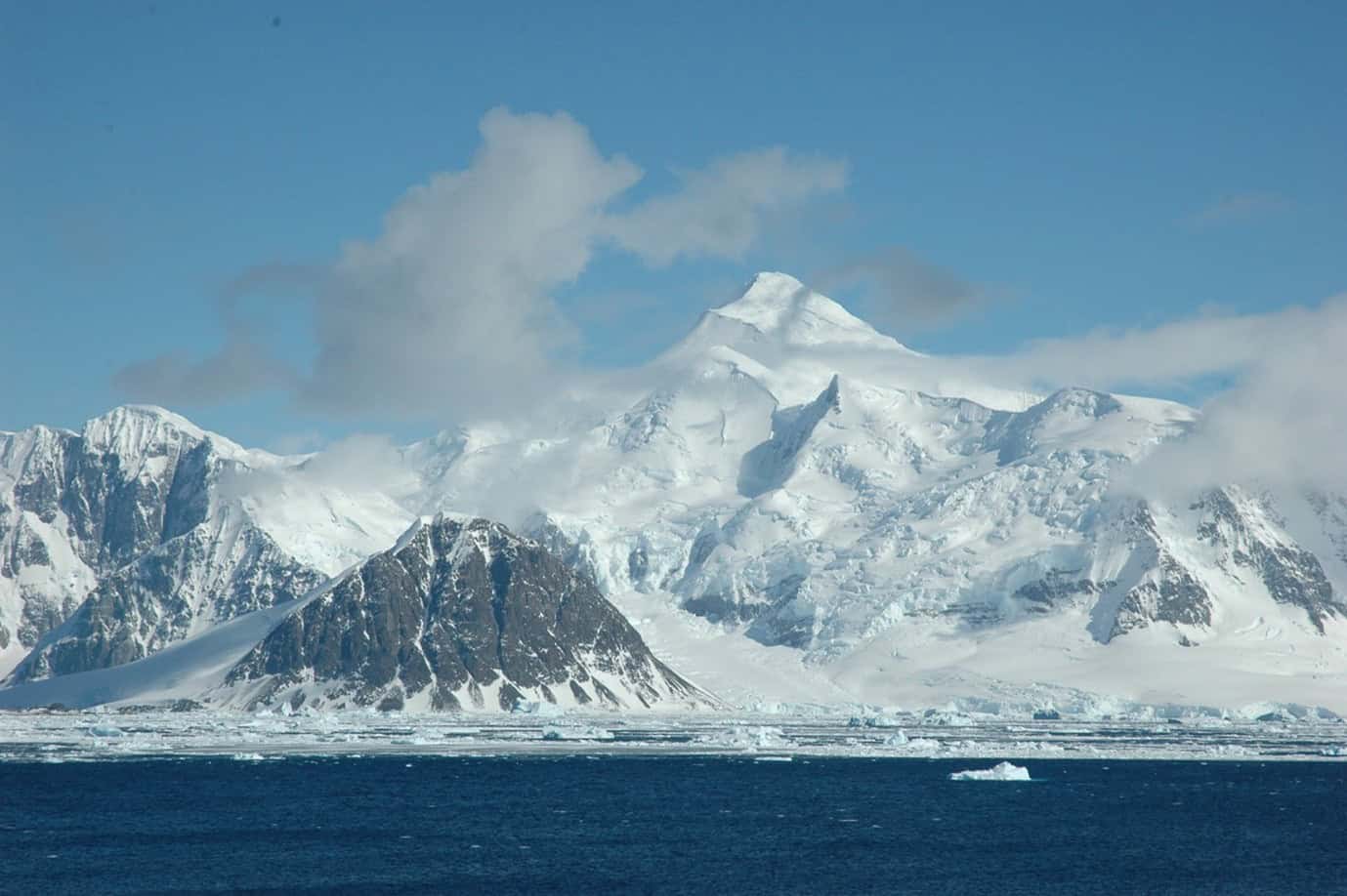 This project offers the exciting opportunity to be at the forefront of research to exploit the potential of exascale computing, for the purposes of satellite monitoring of Earth’s polar ice sheets, at scale.
 The polar regions are one of the most rapidly warming regions on Earth, with ongoing melting of ice sheets and ice caps making a significant contribution to global sea level rise. As Earth’s climate continues to warm throughout the 21st Century, ice melt is expected to accelerate, leading to large-scale social and economic disruption.
Satellites provide a unique tool for monitoring the impact of climate change upon the polar regions, and are key to tracking the ongoing contribution that ice masses make to sea level rise. With recent increases in data volumes, computing power and the use of data science, comes huge potential to rapidly advance our ability to monitor and predict changes across this vast and inaccessible region. However, currently this potential is not fully realized.
This project will place you at the forefront of this research, working to advance our current capabilities towards exascale computing, through a combination of state-of-the-art satellite datasets, high performance compute, and innovative data science methods. You will be supported by a multidisciplinary supervisory team of statisticians, computer scientists and environmental scientists, with opportunities to contribute to projects run by the European Space Agency. Specifically, this project aims to develop new large-scale, high-resolution estimates of 21st century Antarctic ice loss and, in doing so, better constrain our estimates of past and future sea level rise.
Methodology and Objectives
Project Aim: This project aims to utilize new streams of satellite data, alongside advanced statistical algorithms and compute, to transform our ability to monitor Antarctic Ice Sheet mass loss at high spatial resolution and at the pan-Antarctic scale. More specifically, the successful candidate will develop new estimates of ice sheet mass loss using high-volume, high-resolution satellite-derived Digital Elevation Models (DEM’s), using efficient GPU-enabled processing flows. These will be used to determine unique, large-scale estimates of 21st century ice sheet mass loss and glacier evolution.
Methods Used:
This project will build upon recent proof-of-concept work that has developed a novel pipeline for processing high volume (100’s Tb), extremely high (meter scale) resolution timeseries of Digital Elevation Models. The focus of this PhD will be to adapt these methods so that – for the first time – it is computationally feasible to apply them at the ice sheet scale, and then to develop a comprehensive, ice sheet wide assessment, which will ultimately improve our understanding of the impact of climate change on polar ice loss and sea level rise. This will necessitate the use of Graphical Processing Units (GPU’s) on High Performance Computing (HPC) clusters. As such, developing the code to work on this high-level computing architecture will be a key element of the project.
Within the first year of the PhD, the successful candidate will have the opportunity to explore 2 teaser projects, one of which will then be taken forward into subsequent years.
Teaser Project 1: Towards pan-Antarctic, high-resolution monitoring of ice loss
This teaser project will work to translate the current proof of concept DEM pipeline into a system which can be run efficiently at scale, and then to test its use at a number of key Antarctic study sites. Specifically, state-of-the-art satellite altimetry will be combined with high-resolution DEM’s from the Reference Elevation Model of Antarctica (REMA) project, to generate estimates of glacier elevation change covering the period 2010-present. Study sites will be selected to cover those of high scientific interest (e.g. Pine Island Glacier, Totten Glacier), and to explore performance within diverse glaciological settings (e.g. large ice streams, narrow outlet glaciers with nearby nunataks). A key component of this initial project will be to refactor the current code on GPU-enabled systems, alongside developing better approaches to memory management, data infrastructure etc. If continued beyond year 1, the ultimate ambition of this teaser project will be to exploit the full, pan-Antarctica archive of REMA strips, to (1) generate new ultra high-resolution Antarctic Mass Balance estimates, and (2) improve process understanding of the physical drivers of current ice loss.
Teaser Project 2: Multi-sensor integration for multi-decadal monitoring
The second teaser project will again aim to establish efficient, scalable DEM-processing pipelines for resolving Antarctic Ice Sheet mass loss, but this time focusing on extending the observational record to generate timeseries spanning a quarter of a century (2000-2025). This necessitates adapting the proof-of-concept pipeline which forms the basis of teaser project 1, to add functionality to process data from the ASTER mission (2000-present) over Antarctica; thus enabling a long-term record to be derived. Initial work has already been performed to process ASTER data over Greenland using conventional (CPU) systems. Hence the purpose of this teaser project will be (1) to adapt this existing code so that it runs over Antarctica, and (2) refactor it for deployment on GPU’s, with a view to future scale-up. If continued beyond year 1, the ultimate ambition of this teaser project would be to (1) generate new long-term records of Antarctic glacier evolution, and (2) improve process understanding of the physical drivers of current ice loss.
References & Further Reading
Here are some tasters of our work and its impact:
https://www.weforum.org/agenda/2019/05/antarctica-s-ice-is-melting-5-times-faster-than-in-the-90s/
https://www.bbc.co.uk/news/science-environment-47461199
The candidate will also join the UK Centre for Polar Observation and Modelling, and the Centre of Excellence in Environmental Data Science:
-
Project institution:Project supervisor(s):Dr Abdollah Jalilian (University of Glasgow), Dr Faiza Samreen (UKCEH), Dr Andrew Elliott (University of Glasgow), Prof Claire Miller (University of Glasgow), Prof Andrew Tyler (University of Stirling) and Prof Peter Hunter (University of Stirling)
-
Project institution:Project supervisor(s):Dr Mu Niu (University of Glasgow), Dr Craig Wilkie (University of Glasgow), Prof Cathy Yi-Hsuan Chen (University of Glasgow) and Dr Michael Tso (UKCEH)
Overview and Background
Technological developments with smart sensors are changing the way that the environment is monitored. Many such smart systems are under development, with small, energy efficient, mobile sensors being trialled. Such systems offer opportunities to change how we monitor the environment, but this requires additional statistical development in the optimisation of the location of the sensors.
The aim of this project is to develop a mathematical and computational inferential framework to identify the best locations to deploy sensors in a complex constrained domain and network, to enable improved detection of water contamination. The proposed method can also be applied to solve regression, classification and optimization problems in a latent manifold which embedded in higher dimensional spaces.
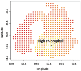
Figure 1, Examples of complex constrained domains: Chlorophyll concentrations in Aral Sea (Wood et al., 2008). Methodology and Objectives
The idea of on-site sensors to detect water contaminants has a rich history. Since water flows at finite speeds, placing sensors strategically reduces time until detection. The mathematical analysis is often made difficult by the need to model the nonlinear dynamical systems of hydraulics within a non-Euclidean space such as constrained domains (lake or river, Wood et al., 2008) or networks (pipe network, Oluwaseye, et al., 2018). It requires solving large nonlinear systems of differential equations in the complex domain and is difficult to apply to even moderate-sized problems.
This proposed PhD project aims to develop new methods to improve environmental sampling, enabling improved estimation of water pollution and associated uncertainty that appropriately accounts for the geometry and topology of the water body.
Methods Used:
Intrinsic Bayesian Optimization (BO) on complex constrained domains and networks allows the use of the prediction and uncertainty quantification of intrinsic Gaussian processes (GPs) (Niu et al., 2019, 2023) to direct the search of the water pollution. Once new detection is observed, the search for a hotspot can be sequentially updated.
The key ingredients of BO are the Gaussian processes (GPs) prior that captures beliefs about the behaviour of the unknown black-box function in the complex domains. The student will develop intrinsic BO on non-Euclidean spaces such as complex constrained domains and networks with the state-of-the-art GPs on manifolds and GPs on graphs. Extending the idea of estimating covariance functions on manifolds, the project aims to estimate the heat kernel of the point cloud, allowing the incorporation of the intrinsic geometry of the data, and a potentially complex interior structure.
The application areas are water quality in lakes with complex domains (such as the Aral Sea) and pollution sources in a city’s sewage network. The methods would have the potential to inform about emergent water pollution events like algal blooms, providing an early warning system, and help to identify pollution sources.
Teaser Project 1 Objectives: In the first teaser project, the student will apply intrinsic GPs to water quality data, seeking to understand the complex patterns of water quality in non-Euclidean spaces (both continuous domains with complex boundaries and network domains). The student will apply existing methods to small-scale datasets, getting a feel of the methodology used in this area. This work could evolve into a PhD with a focus on developing computationally demanding methods for modelling water quality and detecting hotspots over complex domains. Parallelisation over GPUs would enable modelling across large areas, with high data volumes typical of high spatial resolution water quality data.
Teaser Project 2 Objectives: In the second teaser project, the student will expand their work to the spatio-temporal (or manifold-temporal) setting, incorporating both complex spatial and temporal structures to fully explain the changing nature of the water quality patterns. Again, this teaser project will use involve applying existing methods to small-scale datasets. Due to the high computational complexity of spatio-temporal models, this project has the potential to evolve into a PhD with a focus on developing highly computationally efficient methods, with a focus on parallelisation on GPUs.
The student will benefit from the extensive expertise of the supervisory team. Dr Niu specializes in statistical inference in Non-Euclidean spaces, with application in ecology and environmental science. Dr Wilkie has a background in developing spatiotemporal data fusion approaches for environmental data, focussing on satellite and in-lake water quality data. Prof Chen specializes in network modeling, statistical inference, data science, machine learning and economics. Dr Tso is an environmental data scientist with strong computational background and a portfolio of work on water quality monitoring, including adaptive sampling.
References & Further Reading
- Niu, et al., (2019), “Intrinsic Gaussian processes on complex constrained domain”,J. Roy Statist. Soc. Series B, Volume 81, Issue 3.
- Niu, et al., (2023): Intrinsic Gaussian processes on unknown manifold with probabilistic geometry, Journal of Machine Learning Research; 24 (104).
- Oluwaseye, et al.,(2018) A state-of-the-art review of an optimal sensor placement for contaminant warning system in a water distribution network, Urban Water Journal, 15:10, 985–1000.
- Giudicianni et al., (2020). Topological Placement of Quality Sensors in Water-Distribution Networks without the Recourse to Hydraulic Modeling. Journal of Water Resources Planning and Management, 146(6).
- Wood, S. N., Bravington, M. V. and Hedley, S. L. (2008) Soap film smoothing. J. Royal Stat. Soc. Series B, 70, 931–955.
-
Project institution:Project supervisor(s):Dr Amber Leeson (Lancaster University), Dr Matt Speers (Lancaster University), Dr Katie Miles (Lancaster University) and Dr Vincent Verjans (Barcelona Supercomputing Centre)
-
Project institution:Project supervisor(s):Dr Suzana Ilic (Lancaster University), Prof Aneta Stefanovska (Lancaster University), Mr Michael Thomas (Reliable Insights) and Dr Bryan Michael Williams (Lancaster University)
Overview and Background

Rogue waves, exceptionally high ocean waves, whose height exceeds twice the significant wave height, are rare, short-lived events that pose serious risks to shipping, fishing, and maritime infrastructure, including offshore platforms and wind turbines. Understanding their formation and improving prediction are essential for safe marine operations.
Despite advances in theoretical and experimental studies, the physical mechanisms driving rogue wave formation in real seas remain poorly understood, making prediction challenging. This PhD project aims to address these gaps by analysing extensive field data, developing advanced non-linear dynamic techniques, and utilising high-performance computing. The aim is to improve understanding of rogue wave dynamics and enhance forecasting capabilities, thereby contributing to the safety and resilience of marine operations.
[115]
Methodology and Objectives
The PhD project will address the following questions: How can data processing and modelling be accelerated to enable non-linear analysis and modelling with higher spatial and temporal resolution? Which of the sea state parameters predicted by existing operational wave models are useful for detecting the formation of rogue waves? How do the formation and predictability of rogue waves depend on physical conditions?
Teaser 1:
This data-intensive project aims to accelerate novel time-localised analysis methods to investigate physical mechanisms underlying rogue waves and predict their occurrence.
O1: Exploit GPU Accelerated Computing to parallelise algorithms for time-localised phase coherence and couplings between waves recorded in many spatial points, enabling scaling to higher-resolution and near real time analysis.
O2: Isolate the mechanisms leading to the formation of rogue waves using algorithms developed in O1.
O3: Develop in-situ feature detection for automated analyses exploiting GPU and assess the relationship between the occurrence of rogue waves and their characteristics from time-series measured under different physical conditions.
O4: Develop a time-series-based prediction modelling approach, using the relationships identified in O2-3 and assess its ability to predict the occurrence of rogue waves.
Methods:
The numerical modelling and algorithms for time-series analysis will exploit GPU Accelerated Computing; exascale will then allow near real-time practical applications. The Multiscale Oscillatory Dynamics Analysis (MODA) toolbox for non-linear and time-localised phenomena in time-series (e.g. phase coherence, coupling and wave energy exchange [3&4]) will be parallelised and used to identify rogue wave mechanisms. Automated pattern analysis and feature engineering will be applied using Tangent to detect anomalous sea surface elevations and enable an easily deployable computationally light forecasting solution using processed data. The methods will be first applied to laboratory data (e.g. [1]) and then to publicly available field measurements (e.g. Free Ocean Wave Dataset with more than 1.4 billion wave measurements). The newly developed prediction modelling approach will be systematically validated with measured data.
Teaser 2:
This is a data-intensive project focused on the computational optimisation of time series analyses for dynamic systems and the relationship between rogue wave properties and environmental conditions.
O1: Assess the current performance of the numerical tools included in MODA and Tangent in terms of their relevance for detecting the mechanisms of rogue waves and their computational efficiency.
O2: Optimise the algorithms of the tools identified in O1 with multiple GPU to improve time to improve computation time and experimental throughput, enabling large-scale ensemble time-series analyses.
O3: Develop and apply a GPU version of MODA to field measured data to isolate mechanisms that lead to the formation of rogue waves.
O4: Assess the relationship between the occurrence of rogue waves and concurrent ocean and atmospheric data.
Methods:
The Multiscale Oscillatory Dynamics Analysis (MODA) toolbox offers several high-order methods for time-series analysis, some based on wavelets. The high computational demands of uncertainty evaluation methods limits their use for operational purposes. Optimised algorithms, GPU-acceleration and Exascale facilities will enable higher resolution and practical applications. MODA will identify the mechanisms underlying rogue wave formation using field measured time-series of surface elevations (e.g. Free Ocean Wave Dataset). The concurrent environmental data (e.g. surface ocean currents, wind and atmospheric pressure) will be collated either from field measurements or from the operational forecast models provided by meteorological offices. The correlation between the occurrence of rogue waves and environmental parameters, as well as ‘causal’ relationships between the identified mechanisms and the environmental conditions, will be investigated using the Tangent modelling engine which can be incorporated into predictions in the future.
[577]
References & Further Reading
- Luxmoore, J.F., Ilic, S. and Mori, N., 2019. On kurtosis and extreme waves in crossing directional seas: a laboratory experiment. Journal of Fluid Mechanics, 876, pp.792-817.
- Mori N., Waseda, T., Chabchoub A.(eds.) (2023) Science and Engineering of Freak Waves, Elsevier (https://doi.org/10.1016/C2021-0-01205-0).
- Newman, J., Pidde, A. and Stefanovska, A., 2021. Defining the wavelet bispectrum. Applied and Computational Harmonic Analysis, 51, pp.171-224.
- Stankovski, T., Pereira, T., McClintock, P.V. and Stefanovska, A., 2017. Coupling functions: universal insights into dynamical interaction mechanisms. Reviews of Modern Physics, 89(4), p.045001.
- Yang X., Rahmani H., Black S., Williams B. M. Weakly supervised co-training with swapping assignments for semantic segmentation. In European Conference on Computer Vision 2025 (pp. 459-478). Springer, Cham.
- Jiang Z., Rahmani H., Black S., Williams B. M. A probabilistic attention model with occlusion-aware texture regression for 3D hand reconstruction from a single RGB image. In Proceedings of the IEEE/CVF Conference on Computer Vision and Pattern Recognition 2023 (pp. 758-767).
- Jiang Z., Rahmani H., Angelov P., Black S., Williams B. M. Graph-context attention networks for size-varied deep graph matching. In Proceedings of the IEEE/CVF Conference on Computer Vision and Pattern Recognition 2022 (pp. 2343-2352).
-
Project institution:Project supervisor(s):Prof Michèle Weiland (University of Edinburgh), Dr Eike Mueller (University of Bath) and Dr Thomas Melvin (Met Office)
Overview and Background
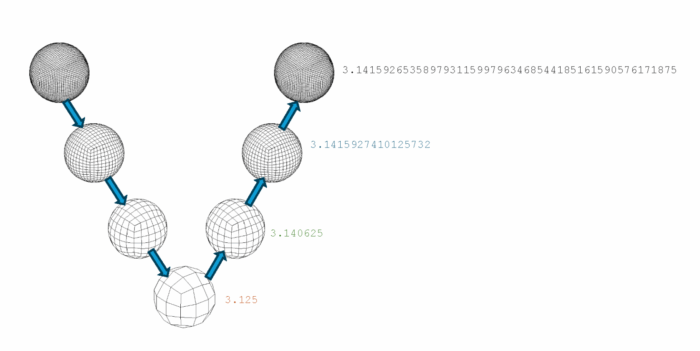
Modern hardware (primarily GPUs) is evolving to make extensive use of floating–point precisions lower than 64-bit (historically the norm for simulation algorithms). This is partly because Machine Learning remains efficient at lower precision, but also because lower precision computational units require reduced silicon area. Lower precision can deliver improved performance through better utilisation of vector units coupled with lower demand on memory and network bandwidth. This project will investigate applying low precision computation to weather and climate simulation codes, such as the Met Office’s new forecasting model LFRic. The focus will be on exploring performance gains to the multigrid solver through mixed precision approaches.
Methodology and Objectives
Codes such as the Met Office’s next generation numerical weather prediction application LFRic already use a geometric multigrid preconditioner in the linear solver (to improve convergence and reduce the number of communication calls between processing units) and mixed precision, where the linear solver and transport scheme are routinely run as 32-bit bubbles within the code and it is planned that the model will run fully at 32 bit, but do not yet take advantage of the smallest precisions (e.g. 16-bit, 8-bit and 4-bit). Geometric multigrid utilises successively coarser meshes, allowing error modes to be selectively resolved by scale. The student will investigate approaches to doing this with a combination of mesh coarsening/refinement and precision coarsening/refinement. The student would be expected to devise approaches for this, initially with simplified model setups (e.g. shallow-water equations) and evaluate them from both computational and accuracy perspectives before ultimately considering how this should be approached in LFRic.
Methodology: The student will develop mixed and low precision multigrid implementations and perform rigorous evaluation of both the performance benefits, in particular focusing on Exascale hardware architectures.
Teaser Project 1: Numerical implications of mixed/low precision multigrid
Reducing the floating-point precision in computation has implications on numerical accuracy. However for multigrid, with its coarsening and refining steps, this reduction in accuracy during the coarsening steps of the algorithm may be acceptable. The student will investigate, using a simple 2D problem, what the impact of lowering precision has on the overall numerical stability and quality of the computation, and how far the low precision can be pushed before the numerics break down. The objectives of Teaser Project 1 are to evaluate how far numerical precision can be lowered safely in the context of multi-grid (looking at both geometric and precision-based refinement) before there is a trade-off with the quality of the results.
Teaser Project 2: Performance impact of mixed/low precision multi-grid
Modern GPUs can accelerate lower precision floating-point operations in hardware, though the exact performance impact is hardware specific and problem dependent. In addition, the use of lower precision floating-point numbers should reduce demands on the memory subsystem and improve the utilisation of vector units. The student will start by using iterative refinement in the current setup (a Richardson iteration preconditioned with a multigrid V-cycle), evaluate the performance improvements that can be achieved through the gradual lowering of floating-point precision, and quantify these improvements (e.g. runtime and memory bandwidth) as a fraction of the theoretical peak. The objectives of Teaser Project 2 are to define the upper and lower bounds of the performance improvements that can be expected from mixing levels of precision, from 64-bit down to 8 or even 4-bit.
-
Project institution:Project supervisor(s):Dr Ankush Aggarwal (University of Glasgow), Dr Tobias Keller (University of Glasgow) and Prof Andrew McBride (University of Glasgow)
Overview and Background
This PhD studentship focuses on developing GPU-accelerated models of magmatic processes that underpin volcanic hazards and magmatic resource formation. These processes span sub-millimetre mineral-fluid-melt interactions up to kilometre-scale magma dynamics and crustal deformation. Magma is a multi-phase mixture of solids, silicate melts, and volatile-rich fluids, interacting in complex thermo-chemical-mechanical ways.
This is a standalone PhD project that is part of a larger framework of magmatic systems research by the wider team. The project will contribute one component of a hierarchical, multi-scale modelling framework using advanced GPU-based techniques. Specifically, in this project, the PhD student will develop constitutive relationships between stresses and strains/strain-rates of various phases at the magmatic system-scale based on granular-scale mechanical simulations (available through an existing collaboration). The result will enable accurate, large-scale simulations of magma dynamics that capture the complexity of micro-scale constituents and their interactions.
Your work will include software development, integrating and interpreting field and experimental data sets, attending regular seminars, collaborating within the wider research team, and receiving training through ExaGEO workshops.
Volcanic eruptions originate from shallow crustal magma reservoirs built up over long periods. As magma cools and crystallizes, it releases fluid phases—aqueous, briny, or containing carbonates, metal oxides, or sulfides—whose low viscosity and density contrasts drive fluid segregation. This fluid migration can trigger volcanic unrest or concentrate metals into economically valuable deposits. The distribution of fluids—discrete droplets versus interconnected drainage networks—crucially depends on crystal and melt properties. Direct observations are challenging, so high-resolution, GPU-accelerated simulations provide a way to understand these complex and dynamic systems.
Methodology and Objectives
A Gaussian-process-based simulation result 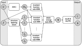
A neural-network-based constitutive modelling framework Modelling volcanic systems is challenging due to the multi-scale nature of their underlying physical and chemical processes. System-scale dynamics (100 m to 100 km) emerge from interactions involving crystals, melt films, and fluid droplets or channels on micro- to centimetre scales. To link these scales, this project uses a hierarchical approach: (i) direct numerical simulations of granular-scale phase interactions, (ii) deep learning-based computational homogenisation to extract effective constitutive relations, and (iii) system-scale mixture continuum models applying these relations to problems. All components leverage GPU-accelerated computing and deep learning to handle direct simulations at local scales, train effective constitutive models, and achieve sufficient resolution at the system scale.
In this project the candidate will extract effective constitutive relations by computationally homogenising the micro-scale mechanical simulations (available through an existing collaboration). The effective constitutive properties will then be used in the macro-scale models to accurately capture the multi-scale effects. The project will leverage recent advances in the use of neural networks [1,2] and Gaussian processes [3,4] for constitutive model development. A range of micro-scale simulation results have already been generated to produce the data covering the different deformation regimes. These results will be used to train a deep-learning-based constitutive model. Approaches based on neural networks and Gaussian processes will be explored and compared. The trained model will then be used in macro-scale simulations, and its results will be compared to those using the constitutive relations currently assumed in the literature. Lastly, the variability resulting from this homogenisation process will be quantified and its propagation into macro-scale simulations will be assessed to ensure confidence in the results. The focus of model applications will be the proposed regime transition from disconnected bubble migration to interconnected channelised seepage of fluids from crystallising magma bodies [5].
Within this project, the student will start by working on two “teaser” sub-projects to gain familiarity with different techniques and data, then choose how to further develop and focus their research.
Teaser Project 1 Objectives: This sub-project, conducted over the first year, will focus on neural networks for constitutive modelling. Neural networks (NN) are the most popular choice of deep learning. Recent works have used NNs for constitutive model development, identification, and discovery [1,2]. With large flexibility in modelling wide-ranging phenomenon, NNs also bring a large number of tunable parameters (weights), associated uncertainty and requirement of large training dataset. This teaser project will explore NNs’ use for constitutive model development based on a simplified one- and two-phase micro-scale systems. This will include finding suitable architecture and training hyperparameters, and the required training dataset. A GPU-based implementation will be developed to make the training of high-dimensional neural networks feasible. This teaser project will pave the path towards a neural-network-based approach for the overall project over the next three years, wherein the initial implementation will be extended to complex micro-scale simulations modelling four phases. Additionally, in the full project, the uncertainty related to neural networks will be quantified, and the required training data will be optimised. These additions will further increase the computational cost, thus necessitating a GPU-accelerated framework.
Teaser Project 2 Objectives: This sub-project, conducted over the first year, will focus on Gaussian process for constitutive modelling. Gaussian processes (GPs) are rigorous statistical tools that are an attractive alternative to neural networks [3]. The main advantage of GPs is that, in addition to the mean, they also capture the variation/confidence in the results, which can in-turn inform which micro-scale simulations must be run to improve their accuracy. Recently, these have been used for constitutive model development for hyperelastic solids [4]. This teaser project will explore GPs’ for modelling the effective constitutive relationships of simplified one- and two-phase micro-scale systems and using the results to also select the required micro-scale simulations. Thermodynamic constraints on constitutive model will be added by extending the GP framework [4], which will increase the training cost. Thus, a GPU-based implementation will be required to make the computation feasible. If this approach is selected for the rest of the PhD, it will be extended to the fully-complex micro-scale model over the next three years. Moreover, the GP approach will be leveraged to develop a robust framework for design of experiments, such that there is a high confidence in the resulting constitutive properties. The design of experiment brings an exponentially high computational cost, thus necessitating a GPU-accelerated framework.
References & Further Reading
[1] Linka, K., Hillgärtner, M., Abdolazizi, K. P., Aydin, R. C., Itskov, M., & Cyron, C. J. (2021). Constitutive artificial neural networks: A fast and general approach to predictive data-driven constitutive modeling by deep learning. Journal of Computational Physics, 429, 110010.
[2] Liu, X., Tian, S., Tao, F., & Yu, W. (2021). A review of artificial neural networks in the constitutive modeling of composite materials. Composites Part B: Engineering, 224, 109152.
[3] Williams, C. K., & Rasmussen, C. E. (2006). Gaussian processes for machine learning (Vol. 2, No. 3, p. 4). Cambridge, MA: MIT press.
[4] Aggarwal, A., Jensen, B. S., Pant, S., & Lee, C. H. (2023). Strain energy density as a Gaussian process and its utilization in stochastic finite element analysis: Application to planar soft tissues. Computer methods in applied mechanics and engineering, 404, 115812.
[5] Degruyter, W., Parmigiani, A., Huber, C. and Bachmann, O., 2019. How do volatiles escape their shallow magmatic hearth?. Philosophical Transactions of the Royal Society A, 377(2139), p.20180017.
-
Project institution:Project supervisor(s):Dr Katie Miles (Lancaster University), Dr Henry Moss (Lancaster University), Prof Philipp Otto (University of Glasgow) and Dr Amber Leeson (Lancaster University)
-
Project institution:Project supervisor(s):Dr Tiffany Vlaar (University of Glasgow), Prof Colin Torney (University of Glasgow), Prof Rachel McCrea (Lancaster University), Dr Thomas Morrison (University of Glasgow) and Dr Paul Eizenhöfer (University of Glasgow)
-
Project institution:Project supervisor(s):Dr Jingtao Lai (University of Glasgow), Prof Todd Ehlers (University of Glasgow), Dr Sebastian Mutz (University of Glasgow) and Dr Katie Miles (Lancaster University)
-
Project institution:Project supervisor(s):Prof Jess Davies (Lancaster University), Prof Lindsay Beevers (University of Edinburgh), Dr Simon Moulds (University of Edinburgh) and Prof Gordon Blair (UKCEH)
Overview and Background
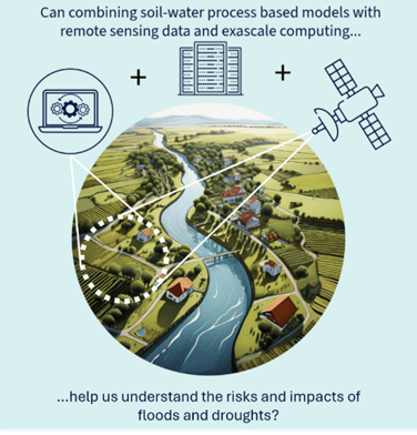
Floods and droughts are increasingly impacting society, ecosystems, and the environment, yet predicting when they will occur and their effects remains a major scientific challenge. Soil–water interactions are at the heart of this challenge, as they are pivotal in storing and releasing water in landscapes, determining plant growth, and nutrient cycling. However, these interactions are highly complex and we currently rely on computationally intensive process-based models to help understand these processes and predict their influence on ecosystem services. With recent advances in satellite imagery and sensing, a wealth of soil moisture data and other relevant data products are now available that could transform these models and our understanding of the risks and impacts of floods and droughts. This studentship focuses on taking advantage of new exascale computing approaches to facilitate data assimilation, exploring how the fusion of big-data with hydrological and biogeochemical soil-water process models can help unlock new insights and understanding.
Methodology and Objectives
Teaser Project 1: The role of soil water storage in drought risk
Objective: Estimate the contribution of soil water storage to mitigating or increasing drought risk in a case study catchment by combining remote sensed soil moisture data, along with meteorological, hydrological and hydrogeological data with hydrological models.
Soil water holding capacity can play a significant role in buffering droughts by storing moisture and supporting groundwater recharge. However, the interactions among precipitation, soil processes, surface flow, and groundwater are complex. Using data-driven methods to explore these relationships could improve our understanding of drought propagation.
Soil moisture is an important component in semi-distributed or distributed hydrological models. However, it is often poorly represented, and it is not routinely updated dynamically throughout the process of a simulation. If we can build data-driven models which relate precipitation to groundwater through soil water interactions in droughts, we could improve our hydrological models by including hybrid processes.
In this teaser, the student will begin to explore different approaches to data assimilation of remote sensing and in-situ monitoring data into hydrological models, focusing on the Tweed to enhance their representation of soil-water-groundwater interactions during droughts.
Teaser Project 2: The effects of droughts on long-term soil carbon cycling
Objective: Improve process-based model representation of the long-term effects of droughts on plant growth and soil carbon through remote sensing data assimilation.
A lack of water can have large effects on plants, especially on annual crops where water conditions can severely affect the plant’s growth and survival. With changing water patterns and increasing frequency of prolonged dry periods, the effects on plant productivity are expected to be large, and there will be knock-on effects for soil carbon storage in the longer-term.
Remote sensing offers many data products that can provide us with data-based insights into plant productivity and soil moisture conditions. However, remote sensing of soil carbon is much more difficult, and understanding of the long-term response to changes in plant productivity still requires process-based models.
In this teaser, the process-based model N14CP, which simulates plant-soil carbon cycling will be adapted to assimilate (Gross or Net) Primary Productivity (GPP and NPP) and soil moisture data remote sensing products during a known period of drought in the UK. Freely available datasets for example from MODIS and SMAP that match the spatial resolution of the model will provide a starting point. This model will be used to explore the long-term effects of droughts on soil carbon.
Shared methods and the pathway to PhD
- Both teasers have a common focus on droughts and involve data assimilation into process-based models. The student will explore a range of approaches: working up from direct insertion to traditional data assimilation approaches (e.g. Kalman filter or particle filtering approaches) to ML-supported approaches (e.g. combining ensemble Kalman filtering with machine learning to reduce compute times) and using ML-based surrogate modelling to speed up process-based model simulation, using for example, Recurrent Neural Network (RNN) methods such as Long Short Term Memory approaches that have been shown to be a promising approach to emulating hydrological systems.
- The two teasers can be developed into two full chapters focused on the use of data assimilation in determining drought risk and knock-on impacts for carbon cycling.
- The PhD can be further developed in a number of other directions, depending on the student’s interests by: i) expanding the focus to floods; ii) developing scaling approaches to move up to catchment and national scales; iii) exploring two-way learning between data and models, iv) trialling real-time assimilation approaches that help move towards a digital twin.
- Exascale/GPU computing will be fundamental in supporting ML data assimilation approaches and hybrid model simulations. For instance, the development of a generalisable ML surrogate model capable of simulating hydrological fluxes and storage processes at the land surface requires training on large spatially and temporally explicit datasets comprising satellite imagery, model outputs, and other relevant data sources. During training, the model must be exposed to as much information as possible to accurately learn the system’s responses to various inputs. A limited dataset reduces the likelihood that the model will capture the full spectrum of system behaviours. This limitation is particularly significant in non-linear systems, such as hydrological systems, where extrapolation beyond the training range becomes unreliable. GPUs will be vital to handling data volumes needed to achieve this, enabling parallelisation of matrix operations on large training data. Greater computational capacity permits the use of larger datasets during training, thereby improving the robustness and generalisability of the surrogate model.
The student’s research will be connected to the Floods and Droughts Research Infrastructure at UK Centre for Ecology & Hydrology, helping connect the student with relevant research and data resources: https://www.ceh.ac.uk/our-science/projects/floods-and-droughts-research-infrastructure-fdri
References & Further Reading
- Plant-soil UK scale model example: Yumashev et al. 2022 Environ. Res. Lett. 17 114054 https://doi.otg/10.1088/1748-9326/aca037
- Hydrological data assimilation example: Li, H., Huang, Y., Qi, Y. et al. 2024. Water Resour Manage 38, 4933–4953. https://doi.org/10.1007/s11269-024-03895-9
- Information on N14CP Model: https://wp.lancs.ac.uk/sustainable-soils/plant-soil-nutrient-cycling-model/
- Flood and Drought Research Infrastructure: https://www.ceh.ac.uk/our-science/projects/floods-and-droughts-research-infrastructure-fdri
Projects with a focus on Geodynamics, Geosciences and Environmental Change:
-
Project institution:Project supervisor(s):Dr Antoniette Greta Grima (University of Glasgow), Dr Tobias Keller (University of Glasgow) and Dr Luca Parisi (University of Edinburgh)
-
Project institution:Project supervisor(s):Prof Jin Sun (University of Glasgow), Prof Andrew McBride (University of Glasgow), Dr Jingtao Lai (University of Glasgow), Prof Todd Ehlers (University of Glasgow) and Dr Eric Breard (University of Edinburgh)
-
Project institution:Project supervisor(s):Dr Chun Hean Lee (University of Glasgow), Dr Antoniette Greta Grima (University of Glasgow), Prof Andrew McBride (University of Glasgow) and Prof Antonio J. Gil (Swansea University)
Overview and Background
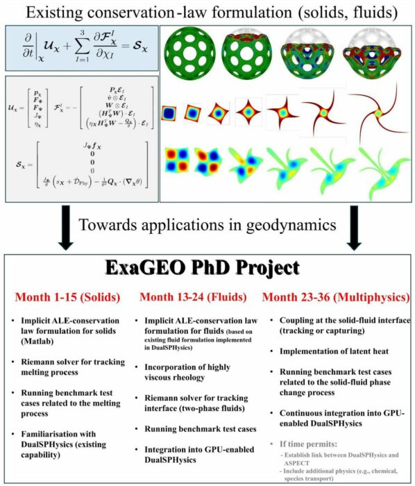
In subducting plates, minerals that contain water or carbon dioxide break down under high pressures and temperatures, releasing fluids [Faccenda, 2014] that enter the overlying mantle wedge. These fluids lower the melting point of mantle rocks, producing partial melts (magmas). The resulting magmas move upward through the mantle and crust (i.e., driven by buoyancy and pressure gradients), where they may accumulate and eventually lead to volcanic activity.
Understanding these coupled solid–fluid–melt interactions is central to subduction modelling. However, current phase change models remain physically and computationally limited, restricting their predictive accuracy and practical use. There is therefore a critical need for robust, GPU-accelerated modelling foundations capable of supporting realistic subduction simulations. To address this, the PhD project builds on a novel mesh-free Smoothed Particle Hydrodynamics (SPH) framework recently developed by the supervisory team. SPH is well suited to this challenge due to its particle-based formulation naturally handles large deformations, free surfaces, and phase transitions (melting and solidification), whilst allowing complex thermo-mechanical and phase-change coupling to be executed in highly parallel, per-particle computations. Based on first-order conservation laws within an Arbitrary Lagrangian Eulerian domain, this framework bridges the gap between solid and fluid dynamics and enables direct adaptation of state-of-the-art CFD techniques to solids, outperforming existing models. With a solid theoretical and computational foundation established, the next stage is to develop and integrate multi-physics phase change capabilities into a unified, GPU optimised framework. Specifically, the project will address three GPU-critical modelling challenges in geophysics:
- Unified formulation for GPU-adaptable SPH: Recast the current multi-physics SPH formulation to unify solids, fluids, and partially molten materials into a single framework explicitly designed for GPU execution. The reformulation reduces thread-divergent branching, minimises global synchronisation, and structures per-particle computations to enable high-throughput, scalable and stable GPU simulations.
- GPU bottlenecks in SPH: Addressing SPH schemes that limit GPU performance, such as irregular particle distributions causing thread divergence, complex rheologies and EOS producing branch-heavy kernels, multi-physics coupling creating high memory demand, large neighbour lists dominating GPU computation, and long-duration simulations accumulating errors due to GPU precision limits.
- High performance GPU acceleration: Creating GPU-optimised data structures and solvers to handle the demanding spatial and temporal resolution required in geodynamics. This includes optimising neighbouring search, data layout, kernel execution, and multi-GPU domain decomposition to enable high-resolution, geological-scale SPH simulations.
Ultimately, this PhD studentship will lay the groundwork for next-generation GPU-accelerated geodynamic models capable of accurately capturing solid-fluid-melt interactions in subduction environments.
Methodology and Objectives
In this project, the candidate will develop a unified, GPU-adaptable conservation-law framework, comprising mass, momentum, energy, phase fraction, species conservation for each phase, to model solid-fluid phase changes, whilst ensuring proper coupling of thermal, mechanical, and chemical effects – key challenges in geodynamics. The candidate will begin by extending the ALE-based thermal-mechanical conservation-law framework [Lee et al., 2024] for solids from an explicit to an implicit formulation. The implicit framework will then be coupled with the fluid phase [Low et al., 2021] by integrating the Navier-Stokes equations, enabling a unified treatment of solid and fluid phases, in contrast to conventional approaches that treat each phase separately [Heister et al., 2017]. To enforce proper coupling, a novel acoustic Riemann solver [Runcie et al., 2022] with a priori knowledge of wave speeds will be developed to handle consistent interface conditions at the solid-liquid boundary. Latent heat effects will be incorporated to maintain thermodynamic consistency and capture energy exchange between phases. As the solid-fluid interface deforms under increasing stresses and phase changes, challenges arise in interface stability, accurate phase-boundary capturing, and energy conservation, which are critical for GPU implementation. To enforce precise phase coupling under large deformations, an adapted Roe-type nonlinear Riemann solver will be introduced to capture the moving phase boundary. When the phase boundary disappears due to volatile release or undergoes complex morphological changes, the framework will switch from Lagrangian tracking to Eulerian capturing using a level set method to reliably handle evolving or vanishing interfaces whilst maintaining GPU-friendly per-particle computations. Additionally, well-posed (polyconvex-based) thermo-visco-plastic models [Lee et al., 2023] will be incorporated to represent the behaviour of solids under complex conditions, capturing temperature-dependent flow, permanent deformation, and combined elastic, viscous, and plastic responses. The extended framework will be rigorously validated against established solid-fluid phase benchmark problems to assess its accuracy, numerical stability, and GPU performance. Finally, the method will be implemented in the GPU-accelerated, open-source SPH code DualSPHysics to handle a wide range of spatial and temporal scales, explicitly addressing GPU bottlenecks in SPH such as memory bandwidth limitations and large-scale neighbour searches. If time allows, a feedback loop between ASPECT (subduction models, https://aspect.geodynamics.org/) and DualSPHysics (melt migration, https://dual.sphysics.org/) may be implemented to iteratively exchange data, enabling continuous refinement of the modelling approach and ensuring consistency between the subduction models and melt migrations simulated with SPH. Chemical effects (e.g., species transport and reactive phase transformations) may also be incorporated.
Within this framework, the candidate will start with two “teaser” sub-projects designed to build a solid foundation in the underlying theory, SPH numerical techniques, and experimental, field, and computational data relevant for modelling subduction phase-change processes. These initial projects are important for acquiring the skills and understanding required to design and implement the full-scale PhD research and to carry out GPU-based simulations with confidence.
Teaser Project#1 (TP#1): The objective of TP#1 is to enable the candidate to understand the mechanics and physical behaviour of both Newtonian and non-Newtonian flows through a simple implementation. Conducted during months 1-9 of the first year, TP#1 will focus on two primary areas:
- Computational mechanics, including conservation laws (e.g., Total Lagrangian, Updated Lagrangian, and Arbitrary Lagrangian Eulerian (ALE)), interface resolution using Riemann solvers, and multi-physics material modelling.
- SPH discretisation, covering stabilisations, consistency, stability, and convergence.
The candidate will begin with a simple explicit-based SPH MATLAB code for single-phase Newtonian flows, then extend it to handle non-Newtonian single-phase flows using an implicit formulation. Challenges in implementing SPH on GPUs will be identified, focussing on the scalability of the neighbouring search, force calculations, and SPH kernel and gradient corrections.
Teaser Project#2 (TP#2): The objective of TP#2 is to familiarise the candidate with the capabilities of DualSPHysics in simulating multi-phase flows on CPU and GPU platforms, which is essential for understanding flow in a geodynamics context. Conducted during months 6 -12 of the first year, TP#2 will focus on exploring the open-source SPH code DualSPHysics. The candidate will test and evaluate its main functionalities, including the single-phase free surface fluid solver and the multi-phase Newtonian/Newtonian solver. Several benchmark test cases will be run and compared on CPU and GPU platforms. Performance metrics, such as accuracy and computational efficiency, will be assessed to evaluate the advantages and limitations of GPU acceleration.
The proposed project is designed as standalone initiative, but it includes a cohort-based learning experience for linked projects related to subduction modelling.
References & Further Reading
- Low, K., Lee, C.H., Gil, A.J., Haider, J. & Bonet, J. (2021). A parameter-free Total Lagrangian SPH algorithm applied to problems with free surfaces. Computational Particle Mechanics, 8, 859-892. https://link.springer.com/article/10.1007/s40571-020-00374-x
- Lee, C.H., de Campos, P.R.R., Gil, A.J., Giacomini, M. & Bonet, J. (2023). An entropy-stable Updated Reference Lagrangian SPH algorithm for thermo-elasticity and thermo-visco-plasticity. Computational Particle Mechanics, 10, 1493-1531. https://link.springer.com/article/10.1007/s40571-023-00564-3
- Lee, C.H., Gil, A.J., de Campos, P.R.R., Bonet, J., Jaugielavicius, T., Joshi, S. & Wood, C. (2024). A novel ALE SPH algorithm for nonlinear solid dynamics. CMAME, 427, 117055. https://www.sciencedirect.com/science/article/pii/S0045782524003116
- Runcie, C.J., Lee, C.H., Haider, J., Gil, A.J. & Bonet. (2022). An acoustic Riemann solver for large strain computational contact dynamics. IJNME, 123, 5700-5748. https://onlinelibrary.wiley.com/doi/full/10.1002/nme.7085
- Faccenda, M. (2014). Water in the slab: A trilogy. Tectonophysics, 614, 1–30. https://doi.org/10.1016/j.tecto.2013.12.020
- Heister, T., Dannberg, J., Gassmöller, R., & Bangerth, W. (2017). High accuracy mantle convection simulation through modern numerical methods – II: Realistic models and problems. Geophysical Journal International, 210(2), 833–851. https://doi.org/10.1093/gji/ggx195
- Nakao, A., Iwamori, H., & Nakakuki, T. (2016). Effects of water transportation on subduction dynamics: Roles of viscosity and density reduction. Earth and Planetary Science Letters, 454, 178–191. https://doi.org/10.1016/j.epsl.2016.08.016
-
Project institution:Project supervisor(s):Prof Radostin Simitev (University of Glasgow), Dr Antoniette Greta Grima (University of Glasgow) and Dr Kevin Stratford (University of Edinburgh)
Overview and Background
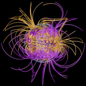
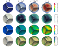
Magnetic fieldlines in a geodynamo simulation by Silva et al (2020) using the code of Silva and Simitev (2018). Scientific computing is crucial for understanding geophysical fluid flows, such as the geodynamo that sustains Earth’s magnetic field. This project will adapt an existing pseudospectral geodynamo code for magnetohydrodynamic simulations in rotating spherical geometries to GPU architectures, improving efficiency on modern computing systems and enabling simulations of more realistic regimes. This will advance our understanding of Earth’s geomagnetic field and its broader interactions, such as those with mantle heterogeneities.
Evidence from seismology and geodynamics shows that the core-mantle boundary (CMB) is highly heterogeneous, influencing heat transport and geodynamo dynamics. By combining compressible, thermochemical convection with geodynamo simulations, this project will further investigate how deep slab properties affect the CMB heat flux, mantle heterogeneity, and the geodynamo.
Methodology and Objectives
Teaser project 1: What is the impact of ancient slabs on core-mantle boundary heterogeneities and the geodynamo?
Evidence from seismology and geodynamics reveals that the lowermost mantle and the coremantle boundary (CMB) are highly heterogeneous due to the presence of post-perovskite, large low shear wave velocity provinces and ancient, subducted slab material. CMB heterogeneity results in variable heat transport from the core and plays a key role in core and mantle dynamics, the geodynamo, and ultimately the Earth’s habitability. Previous work shows that the spatiotemporal evolution of the CMB heterogeneity is closely linked to deep slab dynamics (e.g., Heron et al., 2024, 2025), however these remain poorly understood. This teaser project will investigate the role of deep slab properties on temporal evolution of the deep mantle heterogeneity, the CMB heat flux and the geodynamo. This will involve modelling compressible, multiphase, thermochemical convection in a 3D spherical shell following the approach of Dannberg et al., (2024) and Heron et al., (2024, 2025) using the state of the art, open-source, adaptive mesh refinement, finite element software ASPECT (Heister et al., 2017). These models will include the subduction history over the last 1 billion year from Merdith et al., (2021) and will be supported by high resolution 3D regional models investigating the role of end-member slab properties (e.g., weak vs. strong slabs) on the CMB heterogeneity. Temporal variations in CMB heat flux from these models will then be analysed using spherical harmonics across the first 4 harmonic degrees similar to the approach of Dannberg et al., (2024) and used as thermal boundary condition for the geodynamo simulations. The goal is to expand teaser project 1 to investigate the influence the deep slab on core-mantle dynamics and the implications this has for magnetic field generation and the strength and frequency of polarity reversals.
Teaser Project 1 Objectives:
- Use global convection models to calculate the temporal evolution of heat flux at the CMB
- Investigate the influence of end member slab rheologies and geometries on the heat flux heterogeneity at the CMB
- Apply the calculated heat flux across the CMB from geodynamic models as a boundary condition to geodynamo simulations to investigate heterogeneity in magnetic field strength and the timing and frequency of magnetic field reversals
- Use GPU architecture to couple finite element mantle convection with geodynamo simulations
Teaser Project 2: Spectral expansion transforms in spherical geometry
Modelling the geodynamo involves solving the coupled 3D, time-dependent, nonlinear NavierStokes equations, pre-Maxwell electrodynamics, and heat transfer equations for a rotating fluid. At present, the pseudo-spectral method is the most accurate and widely used numerical discretisation method in this context. The method requires applying physical to spectral space transforms which are generally in integral form and have been difficult to adapt to GPU architectures. With GPUs becoming increasingly powerful and accessible, this sub-project aims to port an existing versatile pseudo-spectral code for magnetohydrodynamic simulations in rotating spherical geometries to GPU systems.
Teaser Project 2 Objectives:
- Investigate alternative orthogonal polynomial basis function families that can be used to expand fields in spherical geometry, including Legendre, Jones-Worland, Jacobi and Galerkin.
- Implement alternatives in and assess/compare convergence, stability and consistency of the resulting discretisations as well as their efficiency for GPU acceleration.
References & Further Reading
Dannberg, J., Gassmoeller, R., Thallner, D., LaCombe, F., & Sprain, C. (2023). Changes in core-mantle boundary heat flux patterns throughout the supercontinent cycle. arXiv preprint arXiv:2310.03229.
Paul H Roberts and Eric M King. 2013. On the genesis of the Earth’s magnetism. Rep. Prog. Phys. 76 096801 http://dx.doi.org/10.1088/0034-4885/76/9/096801
Gary A. Glatzmaier. 2014. Introduction to Modeling Convection in Planets and Stars: Magnetic Field, Density Stratification, Rotation. Princeton https://press.princeton.edu/books/hardcover/9780691141725/introduction-to-modelingconvection-in-planets-and-stars
Heister, T., Dannberg, J., Gassmöller, R., & Bangerth, W. (2017). High accuracy mantle convection simulation through modern numerical methods – II: Realistic models and problems. Geophysical Journal International, 210(2), 833–851. https://doi.org/10.1093/gji/ggx195
Heron, P.J., Dannberg, J., Gassmöller, R., Shephard, G.E., & Pysklywec, R. N. (2025). The impact of Pangaean subducted oceans on mantle dynamics: passive piles and the positioning of deep mantle plumes. Gondwana Research.
Heron, P.J., Gün, E., Shephard, G.E., Dannberg, J., Gassmöller, R., Martin, E., Sharif, A., Pysklywec, R. N., Nance, R.D., & Murphy, J.B. (2025). The role of subduction in the formation of Pangaean oceanic large igneous provinces. Geological Society London, Special Publications, 542(1).
Merdith, A.S. Williams. S.E., Brune, S., Collins, A.S., & Müller, D..R. (2021). Extending fullplate tectonic models into deep time: linking the Neoproterozoic and the Phanerozoic, EarthSci. Rev., 214, Doi:10.1016/j.earscirev.2020.103477
Silva. L, Simitev, R., 2018. Pseudo-spectral code for numerical simulation of nonlinear thermocompositional convection and dynamos in rotating spherical shells,zenodo.org, 1311203, 2018. https://doi.org/10.5281/zenodo.1311203
Projects with a focus on Geologic Hazard Analysis, Prediction and Digital Twinning:
-
Project institution:Project supervisor(s):Dr Mingshu Wang (University of Glasgow), Prof Alison Heppenstall (University of Glasgow) and Prof Jano van Hemert (University of Edinburgh)
-
Project institution:Project supervisor(s):Dr Mark Bull (University of Edinburgh), Dr Maggie Creed (University of Glasgow), Prof Simon Mudd (University of Edinburgh) and Dr Declan Valters (British Geological Survey)
Overview and Background
Flood forecasting at regional and national scale is imperative to predicting the scale and distribution of floodwaters during extreme weather events, mitigating the impact on communities most at risk from flooding. The LISFLOOD family of surface water models have proved suitable to being parallelised at scale, allowing research and forecasting communities to take advantage of the previous generation of supercomputers, such as ARCHER.
The increasing availability of high resolution topographic and meteorological data provides an opportunity to extend the capability of the LISFLOOD modelling framework to produce large-scale or high resolution flood forecasts at operational timescales – i.e., producing model runs at sufficient lead-in times to alert communities to impending flood risk from forecasted extreme weather events. GPU-based exascale HPC systems provide the technological basis to develop forecast models delivering at operational timescales.
Methodology and Objectives
LISFLOOD is a family of hydrological models based on a 2D grid simulating rainfall-runoff. The water routing across a flood basin/river catchment is based on a simplified version of the shallow water (St Venant) equations. The model is process (physics) based, and there have been several implementations (see below), usually in C or C++, using a cellular automaton apporach. These have been parallelised for CPU using OpenMP and in one spin-off project, MPI. (see https://web.jrc.ec.europa.eu/policy-model-inventory/explore/models/model-lisflood/)
The stencil-code library used in the previous CSE project, LibGeoDecomp, purports to have support for NVIDIA GPUs and CUDA. https://github.com/STEllAR-GROUP/libgeodecomp
Teaser Project 1 Objectives:
- Implement the hydrodynamic core of the LISFLOOD model on GPU hardware to demonstrate proof-of-concept that the current CPU parallelised code is portable to GPU hardware.
- Methods for GPU parallelisation would include OpenMP offloading as initial approach to verify proof of concept. Project could then be extended to investigate CUDA bindings available in the libgeodecomp library.
- Profiling of the GPU ported code and identification of optimisation strategies.
Teaser Project 2 Objectives:
- Gather requirements for the full workflow from data acquisition to forecast product dissemination.
- Prototype the workflow for small scale models and conduct experiments to identify potential bottlenecks when scaling up to full resolution.
Development into a full PhD would involve further profiling and optimisation of the GPU code using either the libgeodecomp library, or another suitable GPU parallelisation framework. Delivering a proof-of-concept for a working flood forecast model at a regional scale would be a key aim of this project, demonstrating the potential to be used in operational flood forecasting systems. The full PhD may therefore look at workflow tools to integrate the various stages of forecast production such as: ingestion and pre-processing of data (i.e. from rainfall forecast/nowcasting data products), model scheduling on HPC systems, and post-processing of the outputs.
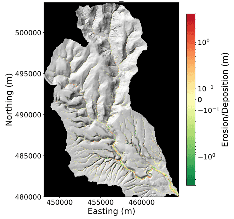
Rendering of total flood induced erosion and deposition of riverbed material during a flash flood event in the Rye catchment, North Yorkshire, UK, used as a case-study when testing the development of the LISFLOOD model. Image source: Declan Valters, British Geological Survey References and Further Reading
LISFLOOD model high level overview: https://web.jrc.ec.europa.eu/policy-model-inventory/explore/models/model-lisflood/)
Stencil Code for LibGeoDecomp: https://github.com/STEllAR-GROUP/libgeodecomp
Open Source version of the C++ code developed by Declan Valters: https://github.com/dvalters/HAIL-CAESAR
Overview of an earlier project that developed an experimental version of the code for multi (CPU) node using stencil code: http://www.archer.ac.uk/training/virtual/2019-12-04-lisflood/lisflood.pdf
Reference for the Hydrodynamic Model Core: Coulthard, T.J., Neal, J.C., Bates, P.D., Ramirez, J., de Almeida, G.A. and Hancock, G.R., 2013. Integrating the LISFLOOD‐FP 2D hydrodynamic model with the CAESAR model: implications for modelling landscape evolution. Earth Surface Processes and Landforms, 38(15), pp.1897-1906.
-
Project institution:Project supervisor(s):Dr Zhiwei Gao (University of Glasgow), Dr Christos Anagnostopoulos (University of Glasgow), Dr Martin Hurst (University of Glasgow) and Dr Hassan Al-Budairi (QTS Group Ltd)
-
Project institution:Project supervisor(s):Prof Andrew Baggaley (Lancaster University), Prof Jason Matthiopoulos (University of Glasgow), Prof Peter M. Atkinson (Lancaster University), Dr Nathan Brown (Forest Research), Dr Suzanne Robinson (Forest Research) and Annabel Narayanan (Action Oak)
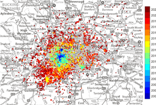
Observations of Oak Processionary Moth (an key invasive plant pest) coloured by observation year, overlayed on a map of greater London Overview and Background
The UK has set ambitious targets to expand woodland cover to nearly 20% by 2050, recognising the multiple benefits of forests for carbon storage, biodiversity, and climate resilience. Delivering these targets requires more than simply planting trees: new and existing woodlands must be resilient to climate stress and safeguarded against invasive pests and pathogens. At the same time, globalisation and climate change are accelerating the spread of invasive species, threatening the long-term success of woodland expansion strategies. This project will develop next-generation, GPU-accelerated environmental models that couple tree growth dynamics, pest spread, and climate forcing within an Earth system framework. By integrating large-scale observation data, the project will generate fine-grained risk forecasts to inform national woodland policy and sustainable land-use planning.
Methodology and Objectives
The project will develop a new spatial modelling (open-source) framework that couples a biological growth model for tree stands with a spatially explicit SIR-type epidemiological model for invasive pests and pathogens using a fully differentiable approach. Specifically, we will adapt existing 3PG models (to to represent stand-level woodland growth) into a differentiable GPU based code. This model accounts for temperature, drought, CO₂, and management. However, at present, a major limitation is explicitly linking canopy openness and stand structure to pest and disease vulnerability. Addressing this shortcoming is one of the main aims of the project.
Climate projections will provide environmental forcing, while observation data from project partners at Forest Research will constrain key model parameters in both the 3PG and SIR models and their coupling. Data integration will account for changes in resolution and modality, enabling high-resolution simulations of coupled pest–climate–tree interactions at scales relevant for both national policy assessments. Differentiability allows the direct use of gradient-based optimisation and Hamiltonian Monte Carlo (HMC), making it feasible to perform efficient parameter calibration and full Bayesian uncertainty quantification in a high-dimensional, spatially explicit model. It also facilitates the development of risk forecasts and scenario analyses for woodland expansion strategies.
Teaser Project 1 Objectives: Woodland Expansion and Policy Support
This project strand focuses on developing and then applying the coupled pest-climate-tree code to key case studies of woodland management and expansion in the UK.
The core goal of TP1 is to fully rewrite the existing 3PG model in a vectorised, GPU compatible, format with auto-diff for gradient computation through physiological sub-models. This will then be coupled to the existing pest/disease code using profiling tools to ensure computational efficiency and scalability. Finally, we will incorporate parameter inference using HMC and train the model on pre-existing datasets for representative tree-pest systems under current and future climates. Key focuses will be a) Sitka spruce and Elatobium aphid (using aphid monitoring data) and b) Oak and multiple pests and diseases (e.g. mildew, Acute Oak Decline, and Oak Processionary Moth).
We will then be able to:
- Quantifying the vulnerability of new and existing woodlands to pest/pathogen outbreaks under climate stress.
- Identifying data-informed planting strategies that balance carbon storage, biodiversity, and woodland resistance.
- Generating fine-resolution maps of pest risk and climate suitability to guide woodland expansion planning at national and regional levels.
This project offers direct policy relevance, producing modelling tools to support expansion strategies that are resilient to compound risks.
Teaser Project 2 Objectives: Digital twinning
This project strand emphasises methodological advances in GPU-accelerated modelling and remote sensing technology to create a digital twin of woodland expansion. The objective is to integrate real time data streams from observations and sensors with different resolutions and modalities with the pest–climate–tree model, enabling real-time or near-real-time assimilation of key data sources, including citizen science initiatives. Specific goals include:
- Scaling the software developed in TP1 to harness exascale facilities for high-resolution environmental modelling.
- Coupling pest–climate–tree interactions to real-time multi-modal observation streams,
- Integrating GPU-accelerated inference schemes to constrain free parameters.
- Developing an accessible user interface to maximise the impact of the project.
References & Further Reading
[1] J.J. Landsberg, R.H. Waring, Forest Ecology and Management, 95, 3 (1997)
[2] K Reed, et al. Ecology and Management, 476, 118441 (2020) -
Project institution:Project supervisor(s):Dr Craig Wilkie (University of Glasgow), Dr Lawrence Bull (University of Glasgow), Dr Stephen Thackeray (Lancaster University), Prof Claire Miller (University of Glasgow), Prof Amy Pickard (UKCEH), Dr Liam Godwin (UHI) and Prof Roxane Andersen (UHI)
-
Project institution:Project supervisor(s):Dr Benn Macdonald (University of Glasgow), Dr Mu Niu (University of Glasgow), Dr Paul Eizenhöfer (University of Glasgow), Dr Eky Febrianto (University of Glasgow) and Dr Mark Bull (University of Edinburgh)
Landscape evolution model of Central Nepal including its range of input parameter types. Overview and Background
Many real-world processes, including those governing landscape evolution, can be effectively mathematically described via differential equations. These equations describe how processes, e.g. the physiography of mountainous landscapes, change with respect to other variables, e.g. time and space. Conventional approaches for performing statistical inference involve repeated numerical solving of the equations. Every time parameters of the equations are changed in a statistical optimisation or sampling procedure, the equations need to be re-solved numerically. The associated large computational cost limits advancements when scaling to more complex systems, the application of statistical inference and machine learning approaches, as well as the implementation of more holistic approaches to Earth System science. This yields to the need for an accelerated computing paradigm involving highly parallelised GPUs for the evaluation of the forward problem.
Beyond advanced computing hardware, emulation is becoming a more popular way to tackle this issue. The idea is that first the differential equations are solved as many times as possible and then the output is interpolated using statistical techniques. Then, when inference is carried out, the emulator predictions replace the differential equation solutions. Since prediction from an emulator is very fast, this avoids the computational bottleneck. If the emulator is a good representation of the differential equation output, then parameter inference can be accurate.
This work is highly relevant to the area of Earth Science research. By facilitating the practical use of these systems through emulation, we can gain insights into Earth’s processes, for example, predicting potential triggers for natural hazards such as landslides. Other insights include; tracing locations of erosion and/or deposition for potential critical resource identification, determining principal and potentially hidden natural or anthropogenic drivers of landscape evolution globally, and gaining further understanding as to how future climate change will affect Earth’s surface.
There are a number of applied and methodological directions this work can be generalised to. For example, since a main focus of this project involves making these systems faster and more efficient for use in practice, a natural extension would be to upscale model resolution to m-scale, allowing for a finer analysis and direct assessment of natural hazard risks. Once the principal work is complete, it also provides a framework for scaling to systems with additional modules, such as including ecological factors, advanced drainage flow routing components, and elements that model high-intensity/high-frequency storm events. Future work could also explore and adapt the improved emulation strategies we develop, making digital twinning more viable for use in Earth Science research, as well as other fields of study.
Methodology and Objectives
Methods Used: Gaussian process interpolation (for building the emulator), Bayesian inference (for parameter inference), geomorphological analyses, surface processes modelling.
Teaser Project 1 Objectives: GPU-accelerated differential equation solver. Geodynamic models in Earth Science are used to simulate a range of natural processes. Landscape evolution models specifically contain, amongst others, equations that describe surface processes such as erosion and sediment deposition as well as rock/surface uplift and aspects of climate change. However, the numerical solver executes consecutively, rather than generating solutions in parallel. This first teaser project will commence at the beginning of the PhD project (semester 1) and will focus on familiarising the student with parallel computing via GPUs, including the optimisation of existing landscape evolution models for GPU use. At the same time, the student will take training from ExaGEO, equivalent to 20 UoG credits, in GPU programming and Exascale principles. This teaser project will support the PhD project in developing robust, reliable and efficient emulators for landscape evolution models, utilising GPU power, which will allow for a denser training set and the inclusion of a broader variety of geomorphological scenarios. This teaser project will also give insight on possible GPU acceleration in the emulation process itself.
Teaser Project 2 Objectives: Emulator development. The second teaser project will look at creating an emulator for a simple mathematical model describing elevation change as a function of spatial and temporal variations in surface uplift and efficiency of erosion. This will take place in semester 2 and the student will also undergo training at the same time from ExaGEO, in statistical and numerical methods in computing, complementing the students research aims at this stage. The skills the student will develop during this teaser project will set them up well, in combination with what they have attained from teaser project 1, to develop efficient emulators for more complex landscape evolution models, as the PhD project evolves.
The student will be well supported by the supervisory team. Dr Eizenhöfer has expertise in landscape evolution modelling and Earth System science, Dr Macdonald and Dr Niu have expertise in developing statistical methodology in the area of statistical emulation and Dr Febrianto has expertise in highly parallelised architecture for scientific computing and will be able to advise on software development and design with open-source vision, as well as aspects of the GPU software development.
References & Further Reading
Rasmussen, C.E., & Christopher K. I. Williams, C.K.I. (2006). Gaussian Processes for Machine Learning. The MIT Press. ISBN 0-262-18253-X.
Donnelly, J., Abolfathi, S., Pearson, J., Chatrabgoun, O., & Daneshkhah, A. (2022). Gaussian process emulation of spatio-temporal outputs of a 2D inland flood model. Water Research. Volume 225. ISSN 0043-1354.
Clark, M. K., Royden, L. H., Whipple, K. X., Burchfiel, B. C., Zhang, X., & Tang, W. (2006). Use of a regional, relict landscape to measure vertical deformation of the eastern Tibetan Plateau. Journal of Geophysical Research: Earth Surface, 111(F3).
Eizenhöfer, P. R., McQuarrie, N., Shelef, E., & Ehlers, T. A. (2019). Landscape response to lateral advection in convergent orogens over geologic time scales. Journal of Geophysical Research: Earth Surface, 124(8), 2056-2078.
Mutz, S. G., & Ehlers, T. A. (2019). Detection and explanation of spatiotemporal patterns in Late Cenozoic palaeoclimate change relevant to Earth surface processes. Earth Surface Dynamics, 7(3), 663-679.
Whipple, K. X., Forte, A. M., DiBiase, R. A., Gasparini, N. M., & Ouimet, W. B. (2017). Timescales of landscape response to divide migration and drainage capture: Implications for the role of divide mobility in landscape evolution. Journal of Geophysical Research: Earth Surface, 122(1), 248-273.
Whittaker, A. C., & Boulton, S. J. (2012). Tectonic and climatic controls on knickpoint retreat rates and landscape response times. Journal of Geophysical Research: Earth Surface, 117(F2).
Yang, R., Willett, S. D., & Goren, L. (2015). In situ low-relief landscape formation as a result of river network disruption. Nature, 520(7548), 526-529.
Zachos, J. C., Dickens, G. R., & Zeebe, R. E. (2008). An early Cenozoic perspective on greenhouse warming and carbon-cycle dynamics. nature, 451(7176), 279-283.
-
Project institution:Project supervisor(s):Prof Mike James (Lancaster University), Dr Tobias Keller (University of Glasgow) and Dr Thomas Jones (Lancaster University)
Overview and Background
Basaltic volcanic systems present a wide range of hazards, including persistent release of toxic gases from lava lakes to eruptions that can inject volcanic plumes kilometres into the atmosphere. To support next-generation hazard forecasting and response, a volcano ‘digital twin’ model will need to assimilate real-time monitoring data with numerical models of sub-surface magma processes. However, near the Earth’s surface, rising magma is a complex and rapidly evolving multi-phase compressible fluid, which makes modelling magma flow highly challenging and computationally expensive. This project aims to develop large-scale conduit models that are capable of being integrated into real-time decision support systems, such as a digital twin. Simulations will need to be sufficiently fast for ensemble modelling to be a viable approach for forecasting hazard change and quantifying associated uncertainties.
Methodology and Objectives
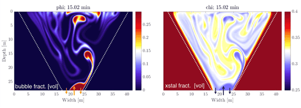
Figure: A three-phase model of bubble-driven and crystal-hindered convection in a basaltic lava lake, as a simpler precursor to the simulations envisaged for this project. Methods Used:
The project will use Julia-based software packages (chmy.jl, ParallelStencil.jl, ImplicitGrid.jl) to develop staggered-grid finite-difference models of thermo-chemical-mechanical evolution of volcanic plumbing systems. The advantage in using these Julia-based solutions is that they allow for simulation codes to be written in a backend-agnostic manner, meaning the same code can be run in an optimised manner on CPU and all major GPU architectures. Models will be custom-built on the basis of the multi-phase reaction-transport model framework of Keller & Suckale (2019). Experimental and observational constraints, as well as state-of-the-art thermodynamic models for gas-melt and melt-solid phase equilibria (e.g., VolFe, MAGEMin), will be used to calibrate the relevant mechanical and thermodynamic properties which govern flow, gas exsolution, and crystallisation reactions.
Teaser Project 1: Melt-gas coupling and magma convection in open basaltic conduits
For this teaser project, you will develop a numerical model of gas loss (degassing) and magma flow within the subsurface plumbing system (i.e., conduit) of a basaltic volcano. As true for many basaltic volcanoes worldwide, you will impose gas influx but no net magma throughput (i.e. an open and degassing system but not generating ash plumes or lava flows). Magma density changes from gas influx at the base, gas exsolution and expansion, and gas loss at the surface will drive convection within the conduit. Simultaneously, heat loss and dehydration will drive partial crystallisation of the magma, which affects its flow properties. Model outputs will include time series of magma pressure, surface height, and gas and magma chemistry to enable comparison with field-measurable geophysical signals (e.g. seismics), remote sensing data (e.g. gas flux and composition), and petrological observations (crystal and glass chemical compositions). You will use this coupled model to map the generation and evolution of flow instabilities and variability across parameter space of conduit geometry, gas influx, and melt composition (affecting density, volatile solubility, and rheology). This will result in a large output database of time series, from which you will extract identifiable patterns and characteristics using machine learning methods. This project, over the course of the PhD, could be extended by additionally coupling the fluid dynamics model with its surrounding solid edifice, to enable simulation of seismic datasets that would be measurable at the surface. Together, the large dataset of model outputs across the full range of the natural parameter space could act as training data to support the automated inversion of real-time observables (e.g., seismics, gas fluxes) to the subsurface flow processes. This would provide an invaluable ‘window’ into the subsurface and support real-time eruption forecasting and response.
Teaser Project 2: Dynamics of basaltic magma fragmentation and gas decoupling during eruption
This teaser project focusses on modelling the gas-driven fragmentation process that can occur in erupting basaltic conduits, and exploring its wider influence on conduit flow. Fragmentation evolves the flow from liquid melt being the connected phase (i.e. gas bubbles within magma) to gas as the connected phase (i.e. fluidal clots of magma within a gas stream). Magma fragmentation results in strong flow viscosity gradients that couple pressure changes into the bulk flow. You will use the model to explore how such changes may influence magma ascent at depth and could drive variability and transitions in eruption style (i.e., lava effusion vs explosive degassing), potentially resulting in large scale, paroxysmal explosive activity. As for Teaser Project 1, a large database of model simulation outputs will enable sensitivities to be explored and any tipping points identified. The project can be expanded by extending the model to encompass above-ground observations, for example, to quantify the expected size and velocity distributions of magma clots or to simulate infrasound signals. Ultimately, this will enable geophysical and remote sensing observations to be inverted for dynamic hazard assessment based on near real-time conduit and eruption conditions.
References & Further Reading
Birnbaum, J., Keller, T., Suckale, J. & Lev, E. (2020) Periodic outgassing as a result of unsteady convection in Ray lava lake, Mount Erebus, Antarctica, Earth Planet. Sci. Letts, 530, 115903. https://doi.org/10.1016/j.epsl.2019.115903
Keller, T. & Suckale, J. (2019) A continuum model of multi-phase reactive transport in igneous systems, Geophys. J. Int., 219, 185–222. https://doi.org/10.1093/gji/ggz287
Jones, T.J., Reynolds, C.D. & Boothroyd, S.C. (2019) Fluid dynamic induced break-up during volcanic eruptions, Nat. Commun. 10, 3828. https://doi.org/10.1038/s41467-019-11750-4
Pering, T.D., McGonigle, A.J.S., James, M.R., Capponi, A., Lane, S.J., Tamburello., G. & Aiuppa, A. (2017) The dynamics of slug trains in volcanic conduits: Evidence for expansion driven slug coalescence, J. Volcanol. Geotherm. Res., 348, 26–35. https://doi.org/10.1016/j.jvolgeores.2017.10.009
Wong, Y-Q & Keller, T. (2023) A unified numerical model for two-phase porous, mush and suspension flow dynamics in magmatic systems, Geophys. J. Int., 233, 769–795. https://doi.org/10.1093/gji/ggac481
Projects with a focus on Sustainability Solutions in Engineering, Environmental, and Social Sciences:
-
Project institution:Project supervisor(s):Dr Xiaochen Yang (University of Glasgow), Prof Jethro Browell (University of Glasgow), Mr Dan Travers (Open Climate Fix) and Mr Jack Kelly (Open Climate Fix)
-
Project institution:Project supervisor(s):Dr M. Sergio Campobasso (Lancaster University), Prof Adrian Jackson (University of Edinburgh), Dr Evgenij Belikov (University of Edinburgh), Dr Wenxin Zhang (University of Glasgow), Dr Andrea Mazzeo (Lancaster University), Dr Stefano Federico (Institute of Atmospheric Sciences and Climate) and Dr Miriam Marchante Jiménez (Orsted)
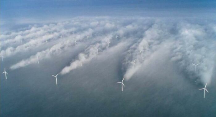
From Hasager, C.B.; Rasmussen, L.; Peña, A.; Jensen, L.E.; Réthoré, P.-E. Wind Farm Wake: The Horns Rev Photo Case. Energies 2013, 6, 696-716. https://doi.org/10.3390/en6020696. Overview and Background
The extraction of energy from the wind yields the formation of low-speed regions (wakes) behind wind farms (WFs). Wakes are particularly persistent offshore [2], and were recently shown to affect the heat exchange between sea and atmosphere, due to reduced convective heat transfer close to the sea surface [1]. With worldwide offshore wind capacity en-route to achieve 2,000+ GW already by 2050, WF wakes may alter ocean dynamics and marine ecosystems to extents comparable to anthropogenic climate change [2]. Evaluating wakes’ environmental impact credibly requires regional- to mesoscale climate simulations with high-fidelity WF parametrizations at temporal and spatial resolution beyond present supercomputers’ capabilities. Using Graphics Processing Unit (GPU) computing [3], this project will develop the code infrastructure to support these simulations on exascale machines, demonstrating prototype physical investigations using the developed technology.
Methodology and Objectives
METHODOLOGY
Two community codes for short-to-long term climate modelling are considered: the Weather Research and Forecasting (WRF) model [4], and the Model for Prediction Across Scales (MPAS) [5]. The codes feature similar models of atmospheric physics, but use different numerical methods. WRF uses structured grids with nested domains to increase resolution in WF wake regions, whereas MPAS uses a single unstructured Voronoi grid with controllable local refinement. WRF has state-of-the-art WF parametrisations [6,7] but little GPU work reported; MPAS uses GPU acceleration but has little work reported on WF parametrization.
This research aims at combining the strengths of both codes to develop a reliable exascale-scalable code for the considered problem. The choice of the baseline code for the project’s core development and demonstrations will follow the teaser projects (TPs) below, which offer hands-on training in climate modelling, wind farm aerodynamics and distributed-memory and GPU parallel computing, and assess the codes’ strengths. Following the TPs, the student will focus on specific topics, e.g. improving the overall code GPU framework or optimizing the parallelized WF model in existing GPU framework, depending on the code selected.The TPs will share one test case, to compare the two codes’ predictive capabilities and computational performance (execution speed) without GPU acceleration. The GPU development work will be performed on Lancaster University’s HEC cluster and the Bede supercomputer [9].
Teaser project 1 (TP1): WRF-based. To investigate and optimize the predictive capabilities of the two WF parametrizations [6,7] in WRF, analyses (TC1) of the North Sea area containing two real WFs [10] will be performed. The capabilities of both models to predict wind turbine (WT) and WF wakes will be optimised using regression methods for the models’ parameters, and lidar and satellite wind speed measurements to steer the optimization. Measured WT power will also be used in the process, as this parameter is affected by wakes.
A second test-case (TC2) without WFs will be used to perform parallel profiling studies of WRF, identifying the code’s computationally most intensive parts and familiarising with its structure. These analyses will identify the code sections that would benefit most from GPU acceleration.
TC2 will also be used to cross-compare the predictive capability of WRF and MPAS, assessing it by comparing predicted near-sea surface wind speed maps to measurements from satellites and lidars. Boundary and initial conditions for TC1 and TC2 will be taken from the ERA5 global climate reanalysis [8]Teaser project 2 (TP2): MPAS-based. First, TC2 will be set up and analyzed without GPUs to cross-compare the computational speed and prediction capabilities of wind speed field of MPAS and WRF. Then, more comprehensive TC2-based parametric analyses of the performance of MPAS using different numbers of CPUs and GPUs will be undertaken to study the dependence of the computational performance of the hybrid parallelization on the CPU and GPU counts, and determine the largest achievable acceleration and the corresponding optimal ratio of GPU and CPU counts – an information paramount for exascale porting. These analyses also enable familiarising with the MPAS structure, knowledge needed to optimally merge wind farm models with the MPAS GPU infrastructure.
Teaser Project 1 Objectives:
- Familiarise with WRF: assess predictive capabilities of 3D wind fields with/without WFs; analyze/optimize best suited WF parametrization.
- Assess computational performance and estimate potential of GPU acceleration.
Teaser Project 2 Objectives:
- Familiarise with MPAS: assess predictive capabilities of 3D wind fields; investigate performance of hybrid CPU/GPU parallelisation.
- Investigate optimal integration of WF model into GPU framework.
References & Further Reading
1) Akhtar, N. et al., Impacts of accelerating deployment of offshore wind farms on near-surface climate. Sci Rep 12, 18307 (2022). https://doi.org/10.1038/s41598-022-22868-9.
2) Platis A. et al., First in situ evidence of wakes in the far field behind offshore wind farms. Sci Rep. 2018;8(1):2163. https://www.nature.com/articles/s41598-018-20389-y
3) Hijma, P., et al. Optimization techniques for GPU programming. ACM Computing Surveys 55.11 (2023): 1-81, https://dl.acm.org/doi/10.1145/3570638.
4) Powers, J. G., et al. “The weather research and forecasting model: Overview, system efforts, and future directions.” Bulletin of the American Meteorological Society 98.8 (2017): 1717-1737. (see also: Weather Research and Forecasting (WRF) model, https://www.mmm.ucar.edu/models/wrf).
5) Skamarock, W. C., et al. “A multiscale nonhydrostatic atmospheric model using centroidal Voronoi tesselations and C-grid staggering.” Monthly Weather Review 140.9 (2012): 3090-3105. (see also: Model for prediction across scales (MPAS), https://www.mmm.ucar.edu/models/mpas).
6) Fitch, A. C. et al., Local and Mesoscale Impacts of Wind Farms as Parameterized in a Mesoscale NWP Model, Mon. Weather Rev., 140, 3017–3038, https://doi.org/10.1175/MWRD-11-00352.1, 2012.
7) Volker, P. et al., The Explicit Wake Parametrisation V1.0: A Wind Farm Parametrisation in the Mesoscale Model WRF, Geosci. Model Dev., 8, 3715–3731, https://doi.org/10.5194/gmd-8-3715-2015, 2015.
8) ERA5 Global Climate Reanalysis. https://www.ecmwf.int/en/forecasts/dataset/ecmwf-reanalysis-v5.
9) N8 CIR, The Bede supercomputer. https://n8cir.org.uk/bede/.
10) Orsted, Offshore wind measurement and operation data. https://orsted.com/en/what-we-do/renewable-energy-solutions/offshore-wind/offshore-wind-data. -
Project institution:Project supervisor(s):Prof Jethro Browell (University of Glasgow), Dr Joe O'Connor (University of Edinburgh) and Dr Tiffany Vlaar (University of Glasgow)
-
Project institution:Project supervisor(s):Prof Adrian Friday (Lancaster University), Dr Carolynne Lord (UKCEH), Dr Kelly Widdicks (UKCEH), Dr Kirsty Pringle (University of Edinburgh) and Prof Mike Berners-Lee (Small World Consulting)
-
Project institution:Project supervisor(s):Dr Alex Bush (Lancaster University), Dr Katherine Simpson (University of Glasgow), Prof Richard Reeve (University of Glasgow) and Dr Ben Payne (Natural England)
Overview and Background
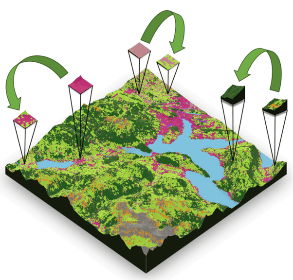
To transform societies towards a sustainable footing we must reposition how environmental impacts are considered within standard economic models. Nature Markets are emerging as a means of mobilising finance and incentivising sustainable land management and ecosystem restoration, but also risk becoming greenwash. A key challenge is how biodiversity units are measured and traded, as this underpins both ecological success and economic efficiency. The recently developed irreplaceability metric offers a promising solution by capturing ecological complexity while supporting cost-effective investments. However, uncertainties in data, climate impacts, and socioeconomic factors remain critical concerns. Addressing these challenges through integrated risk management and advanced data science offers an opportunity to design resilient and credible Nature markets that align economic and conservation objectives.
Methodology and Objectives
In the last 5 years the UK has passed some progressive environmental policies that other nations are hoping to learn from and emulate. Increasing private investment through nature markets is a core goal, and Biodiversity Net Gain (England) defines a mandatory obligation for developers to engage with ecosystem restoration. Gaps in the current legislation and policy have been widely publicised, but it remains a step in the right direction. This project will build upon the irreplaceability metric proposed by Bush et al (2023), drawn from the literature on systematic conservation planning (SCP), to define the strategic value of landscapes. If successful, a method for systematically scoring Nature will offer a robust and transparent framework for achieving Nature positive futures that serve everyone – and change how society perceives Nature and the services we gain from it.
While the original concepts could be demonstrated with basic simulations, and could adopt several simplifying assumptions, to operationalise this new form of nature market will require the development of new tools to suit the volume, velocity and variability of Big Data, be flexible to users demands, and face the realities of sparse and incomplete environmental data. The first teaser therefore focuses on strengthening our ability to reassure stakeholders the recommendations are robust to uncertainty. User’s concerns over uncertainty also underpin the second teaser, which seeks to show how irreplaceability markets would create an opportunity to optimize new monitoring and data collection and reduce costs. Each will require new method development, as well as adaptation to maximise efficiency within CPU/GPU environments.
Methods: The project will combine simulation modelling with prototype policy scenarios using UK environmental data. Simulations allow testing of strategies under “complete knowledge” conditions, enabling rigorous evaluation of uncertainty management. Conversely while true ecological and environmental data are incomplete, defining spatial covariance and distribution of features helps refine the problem space, as well as improve the communication of the project outcomes.
Teaser Project 1 Objectives: Promises of environmental sustainability can be achieved through market means will only be trusted if decisions are transparent. Yet, uncertainties emerge at many stages including our knowledge of ecosystems, how to restore them, profitability for landowners, and of course outcomes over long-term forecasts. Standard approaches to SCP do not integrate objectives for risk that arise from future climate uncertainty, but tools exists within the risk management sector for precisely this purpose and provide a rich opportunity for innovation. This project will test how to integrate different sources of uncertainty through existing methodologies like Modern Portfolio Theory, alongside those that preserve the benefits of the systematic approach to Nature markets. Subsequent tasks could then focus on the further challenge to scale those solutions to Big Data, including UK relevant datasets on land use, biodiversity, land values and climate change scenarios.
Teaser Project 2 Objectives: Monitoring is fundamental to any systematic approach, but diverse ecological and environmental surveys cannot be sustained at large scales posing a potential barrier to the market. However, when sources of uncertainty are identified and a decision criterion is well defined (i.e. irreplaceability), we can act systematically to reduce the uncertainty present by understanding the Value of Information (VoI). VoI methods are commonly used in other fields but have been rarely adopted in conservation settings. This project provides a chance to demonstrate how monitoring and research can become highly organised, taking advantage of a range of novel technologies at different times to minimising the regulatory costs. We propose exploring Bayesian Decision Analysis, Information-Gap Decision Theory, and Real Options Analysis to evaluate VoI adaptive learning strategies on synthetic environments to improve scalability, before proceeding to UK national datasets.
References & Further Reading
Bush et al. (2024). Systematic nature positive markets. https://doi.org/10.1111/cobi.14216
Hanley and Simpson (2025), Markets in Biodiversity Offsets. https://doi.org/10.1111/1467-8489.70027
Bolam et al. (2019), Using the Value of Information to improve conservation decision making. https://doi.org/10.1111/brv.12471
Popov et al. (2022). Managing risk and uncertainty in systematic conservation planning with insufficient information. https://doi.org/10.1111/2041-210X.13725